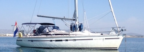
Three pit stops
Rabaul, Papua New Guinea was the last place we got provision, fuel and water before we started on the last leg of our journey to the Philippines. We still needed to sail 2,000 NM. (3,600 kms) but to shorten the journey we decided to make a few pit stops on the way to rest.
The couple from New Zealand, Heather and Mark from “Ajax” who we met in Vanuatu suggested that we stop at Hermit island because the people there are friendly and there are also manta rays and at Longan island because they had a wonderful experience there. So we decided to follow their suggestion and stop at these two islands.
Hermit Island, PNG
We sailed from Rabaul to Hermit island in four days. We had to motor most of the time because we didn’t have a lot of wind. At Hermit island we anchored at the same spot the “Ajax” anchored. However, one of the locals Bob came to us in his canoe and told us that it was better to anchor at the other side of the island right in front of his house because the anchorage was calmer there. When we asked about the manta rays he said that these were also in front of his house so we decided to move to that anchorage. He said the best time to see the manta rays is during high tide which was about 8:00 in the morning. So the next morning he went snorkeling with us and showed us the spot. About 50 meters from the shore and at about 6 meters deep we already saw one manta ray hovering above a large rock and a few minutes later three more came. The four manta rays were gently circling above the large rock and they were not afraid of us. It was an awesome experience! After snorkeling with the mantas for two hours Erwin swam to the boat to check our anchor and when he came back he said he saw five manta rays swimming close to our boat.
When we told Bob and his wife Evelyn that our next stop was at Longan island he said that we should look for his sister Nellie and brother-in-law Campbell who live there. He also said that Campbell could show us the best place where we could anchor.
Longan island (part of the Ninigo island group), PNG
Although there was not much wind, it took us less than 24 hours to sail to Longan island. As soon as we were close to the island a local in a canoe approached us and coincidentally it appeared to be Campbell! He showed us where to anchor at a very nice and calm anchorage right in front of his house. The same afternoon we visited the village and another local, Oscar showed us around the village and introduced us to everyone from the island. There are in total six families living on Longan Island. He also showed us the primary school. There are 45 children studying there and these students are not only from Longan but also from the other islands of Ninigo. The village is clean and well maintained with paths lined neatly with plants but there is no electricity-net, no mobile network, no motorized vehicles, no stores and their fresh water is rainwater collected in huge tanks. What most people do have are solar panels with batteries and inverters. Their main means of transportation is the traditional Ninigo sailing canoe. Everyone in the Ninigo islands knows how to sail and they are very proud of their sailing canoes which can go really fast. They even have an annual sailing competition with participants from the whole Ninigo island group. On our journey we haven’t seen an island that is so friendly, neat and organized as Longan.
The locals caught a large turtle that day which was cooked for the whole village to feast on and we were also invited to stay for dinner. They turned on some music during dinner and what’s surprising is that they all love Country and Western music! Campbell asked if we like to eat lobsters and coconut crab and invited us for lunch at his home the next day. Of course we could not turn this down😜. Erwin asked if he could go with him the next morning to go spear fishing and to find lobsters. So the next day at 7 am. we went snorkeling with Campbell and Maxim, a young kid that joined us and paddled the boats alongside us while we where snorkeling. Unfortunately we didn’t find any lobsters at this spot but Campbell and Maxim went to another spot and there he was able to catch four lobsters and some tasty fish which his wife Nellie prepared for lunch. After lunch we visited the school and donated some writing materials, DVD movies and balloons which we presented to the head teacher. All the students were gathered together in the class and I had to say something about our journey, the Philippines and Holland in front of the whole group. We then went back to Campbell and Nellie’s house where they were waiting for us with a rum “cocktail”. Campbell then handed over to us a model of the traditional Ninigo canoe which he carved himself from wood and said it was a gift. It was really too much.

-

- With Campbell and Oscar
-

- Campbell with his model canoe
We were invited the next day by Oscar and his wife Karen for lunch but before we went there Erwin and I had to clean the bottom of the boat first. When Campbell saw that we were cleaning the boat he swam over to us and offered to help us out. After a few hours of cleaning, we went to Oscar and Karen’s house and Campbell and Nellie joined us. We later found out that they were related to each other. It seems that everyone in the Ninigo island group is in a way related to each other. If you draw a family tree of Campbell and Nellie’s family it will be linked to all the families in the Ninigo islands and will look like one big net.
Before we started lunch they formally welcomed us by singing a welcome song to us. They said that they always sing the welcome song when they have guests visiting their island and we were the fifteenth boat this year. They gave me a straw hat and a necklace made of beads. Oscar’s wife Karen prepared giant clams for lunch (which Oscar caught that morning) and after lunch they invited us to sail with them in their traditional sailing canoe.
The locals gave us fresh fruit, vegetables and eggs and they never asked for anything in return. When they found out that Erwin was a “technician” they asked if he could help repair some things like a broken inverter, DVD-player or amplifier. Erwin looked at these things but unfortunately he could not help them because he didn’t have the spare parts to replace the broken parts.
The day before we left there was a farewell lunch organized for us and everyone present at the village was invited too. We had a wonderful time but after five days we needed to move further. On the day we left Campbell, Nellie and a few children bid us farewell by singing a farewell song to us.
Our stay at Longan island was a unique experience. The locals have welcomed us to their homes and have made our stay there a memorable one. It is definitely one of the highlights of our trip and our friends there will always have a special place in our hearts.
-

- Saying something in front of the class
-

- Farewell lunch
-

- Farewell lunch with the whole village
Helen Reef, Palau (shortest pit stop)
Our last pit stop was Helen Reef which is the most southern island of Palau. Helen Reef is a preserved marine park and there are only three park rangers living on this atoll.
We only needed to sail 800 NM (1,440 kms) from Longan Island to Helen Reef but we were in a huge doldrum and so most of the time we were just floating with the current. We used our engine once in a while but we wanted to use our fuel sparingly in case we needed it for an emergency. After ten days of sailing we finally arrived at Helen Reef. On the electronic charts (e-charts) the passage to the atoll was wide and deep and looked like an easy entrance. Far before we were at the entrance of the passage, I went to the front of the boat to station myself to be on the look out. I was not even standing there for a minute when all of a sudden I saw that the deep blue water changed color and we were already above a shallow reef. I shouted to Erwin to slow down and to back up but it was already too late and we ran aground on the reef. 😬😬 We could not understand what happened because according to the e-chart we should have been in deep waters but when we looked around us we saw that the passage was about half a mile further south. That meant that the GPS position and the electronic charts were not matching!! It was also very difficult to see where the reef was from far ahead because it was early in the morning and a bit cloudy. Erwin jumped in the water to check under the boat and saw that the bottom of the keel ran aground on a flat reef so if we went full throttle in reverse we might slide back to deeper waters. Fortunately, after a few attempts, it worked and we were back in deep waters without any serious damage.
Erwin said that Helen Reef was very rich in marine life because in the few minutes that he was in the water he saw a lot of large parrot fish and schools of fish swimming there. Helen Reef was probably the best place we ever have been for snorkeling and diving. However since we could not rely on our charts and could not visually navigate we decided it was not worth any risk of running the boat aground in the middle of nowhere. So, although it was a pity, we decided not to stop and just continued on sailing the last 700 NM (1,260 kms) directly to the Philippines.
The last miles
The distance of Helen Reef to the closest point in the south of the Philippines was just 300 NM (540 km) but we have been warned not to enter through the south because there were risks of piracy. Cruisers have been kidnapped for ransom in this area in the past and although it is not in the entire south but only in certain “no go” areas we did not want to take any risks. So we decided that our point of entry would be in Samar much further up north with a distance of 700 NM (1,260 km). Compared to the other trips we have done so far this was not really a long distance. So, we thought this was going to be a piece of cake. Of course it did not turn out as easy as we expected.
When we changed the electronic card of our plotter to the chart of the Philippines, the card did not work because it was corrupt. We had another program in the laptop with electronic charts but this was not as detailed as the plotter chart so it was not very reliable. However it was the only one we had and was certainly better than nothing.
September is the typhoon season in the Philippines so it was important that we were informed of any typhoons approaching. Most of the typhoons that hit the Philippines originate in Micronesia and this was the route that we were sailing. Thanks to our crew on land Guido IJzermans we received the weather forecast daily through the satellite phone.
Our route was now to the north-west and although we had a lot of squalls the first two days went fine. But on the third day the wind decreased and changed direction and was blowing from the north-west against us. Furthermore there was a strong current of almost 2 knots (3.6 km) pushing us to the east, away from the Philippines. We decided to roll in the sails and use the engine but because both the wind and the current were against us our speed was only 1 knot (1,.8 km) towards our destination!! At this speed we would have used up all our fuel and not even be one third of the way. So to use the engine at that point was certainly not an option. We decided that it was best to use the sail as long as there was wind and head up north. But because the current was so strong we still were slowly drifting further away from our destination. To make matters worse there was so much floating debris such as logs, branches, plastic bottles, plastic bags, rubber slippers, etc. We have never seen so much garbage in the ocean and were afraid we would hit a log or a plastic bag would get entangled in the propeller.
The next day the wind died down completely but one positive turn of event was that although the current still came from the opposite direction the strength decreased to 0,5 knots. We also noticed that there was no more floating debris in the ocean so we figured that this had something to do with a strong “centrifugal” current that we passed. We were in a doldrum and so without any wind we would slowly drift with the current back to Holland 😜. We did not want to wait for the wind to return because we wanted to get out of the typhoon area as soon as possible so we turned on the engine again and this time we were averaging a speed of more than 3 knots (5.4 km). To shorten the distance to the Philippines by 100 NM (180 km) we moved our waypoint to the island Leyte which was more to the south and then calculated how long it would take us to motor the rest of the distance at this speed and how much fuel we would consume. Although it would be a very close call we thought it was possible to motor the entire distance in five days.
Sometimes we would have wind for a few hours so we would turn off the engine and hoist the sail. Once the wind died down we would use the engine again. This happened several times on and off. We were really glad when we had wind even if it was just for a short time because that meant that we were getting more allowance on our fuel.
For two days we were kept company by a white bird that looked like a Heron. In the beginning it kept its distance from us but when it realized that we were not a threat to it, it slowly entered the cockpit. It was so at ease with us and it stayed inside the cockpit the whole time even when we were there. One time, Erwin needed to hoist the sail and since our friend was blocking his way, Erwin pushed him aside but instead of flying away it pecked Erwin on his hand 😲. On the second day he finally took off and we never saw it again.


When we were getting closer to the Philippines we saw more fishing boats and “bangkas” which is a traditional Filipino outrigger boat. They would regularly come to us and ask if we had cigarettes. We asked one of the larger fishing boats if they had extra diesel and if we could buy a few jerry cans from them. They replied with “yes we have diesel but we first have to go to our mother ship and we will come back after”. This was their way of saying no because of course they never came back. Fortunately, when we finally arrived in the Philippines we still had a half tank full which was much more than we calculated.
First step on my homeland
We entered the Philippines through the Surigao Strait which is also where Ferdinand Magellan, the Portuguese explorer who headed the Spanish fleet entered in the year 1521.
It was hard to believe that we left Holland more than a year ago and were now actually in the Philippines. The very first place we stepped foot on my homeland was a small town on Dinagat Island. We moored on a commercial wharf and when we went to the port authority they told us that we were the first sailboat that ever arrived in that town. A lot of people came to look at us and they would take selfies with our boat in the background. The first thing we did was made sure our fuel tank and all jerry cans were filled. We then went to town to download another electronic chart on the I-pad but the connection was so slow it was taking forever to download anything.
We were planning to rest here for a few days but the wind changed direction and so on the first night our boat was being banged against the wharf. The next day we saw that the wooden bumper of the boat was damaged and so we decided that we couldn’t stay there any longer if we wanted to keep the boat in one piece so we decided to leave as soon as possible.